The project

What this map is for

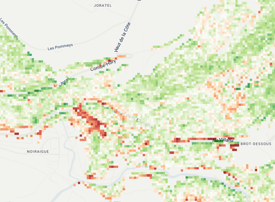
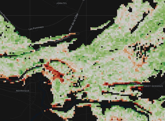
Satellite images of every summer month, 2017–2026. One question: where is vegetation performing below its typical level?

✓Use it to

  • Screen a region for forest stands (groups of trees) doing worse than usual
  • Compare the same forest stand across years, same month
  • Prioritise field visits: where to walk first

✕Do not use it to

  • Call a tree dead. A low value is not proof of death
  • Measure health or biomass. It only shows the change from the usual level
  • Name a cause. Drought, heat, pests, storms and logging all look the same

ValidationValidation is under way. Results expected October 2026.
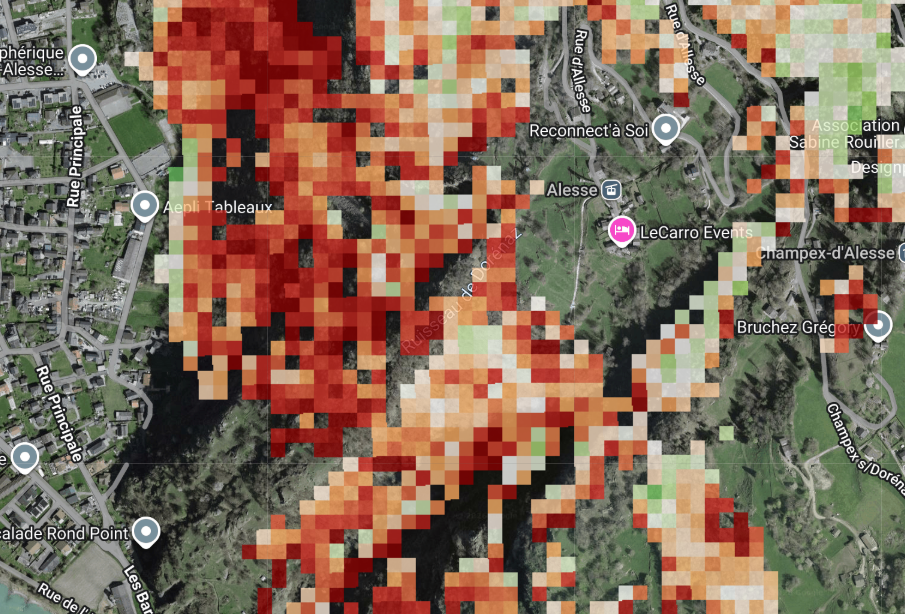
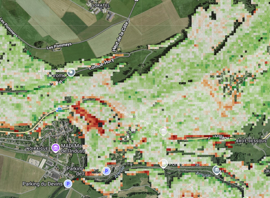
July 2022, vegetation condition

Example values and interpretation

−2.1 σ Severely stressed Far below the usual level for this location in July. Worth a visit. Not proof that the trees are dead.
−0.4 σ Typical Inside the usual range for July. Nothing to flag.
+1.4 σ Healthier than usual Above the usual level for this location in July.

TreeAI · treeai.earth

1 / 4

Sentinel-2 · 20 m · Switzerland

Vegetation condition

Four vegetation indices are combined into one score: how far this month is from its usual level.

4

indices

3

months, Jun–Aug

2017–2026

reference years

20 m

pixel
NDVIgreenness
GNDVIchlorophyll
NDREstress, senescence
NDWIcanopy water
< −2severely stressed
−2 … −1moderately stressed
−1 … +1typical
+1 … +2healthy
> +2very healthy

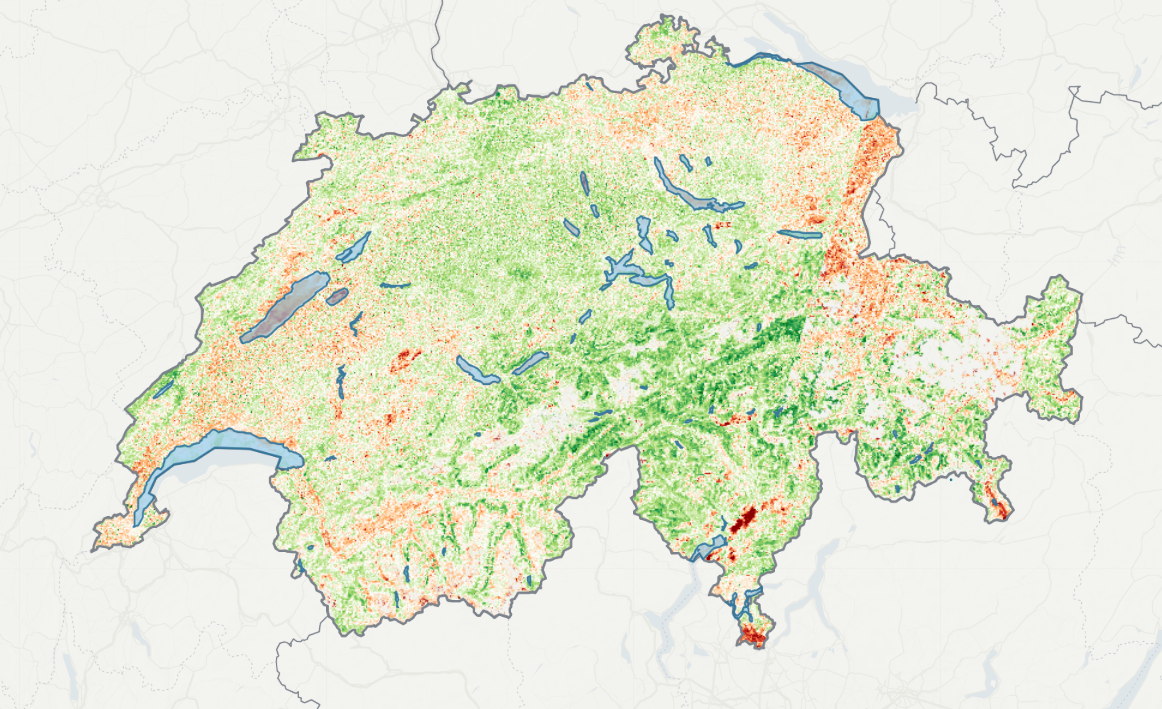
Vegetation condition across Switzerland

−2.5−10+1+2.5

How the score is calculated

$$z_i = \frac{x_i - \mu_i}{\sigma_i}$$→$$V_{\text{condition}} = \frac{\sum_{i=1}^{n} z_i}{n}$$

xi the index for the selected month and year · μi, σi its mean and standard deviation for the same month in all other years · n valid indices, 1–4

TreeAI · treeai.earth

2 / 4

In the field

Operation guide

1

Locate yourself: tap the GPS icon to put your position on the map, or type the place in the search bar.

2

Pick month, year, index: in Layers. June, July, August · 2017–2026 · combined, or one of the four indices.

3

Tune what you see: basemap (white, black, satellite), opacity, forest mask, until the map is easy to read.

4

Select an area of interest, open Chart: click a stand to see its history, 2017–2026. On a computer the chart sits on the right; on the phone, the chart is a tab in the bottom panel.

Recommended field preset Satellite basemap · opacity 60–70% · forest mask on

The satellite basemap is Google imagery: some tiles are leaf-on, some leaf-off.
1 2 3 4
Basemap: white · black · satellite
Scale
Chart
Layers
Month
Map year
202020212022 20232024
Index
Vegetation condition▾
Forest mask
Opacity
65%
Jul▾ 2022▾ Vegetation condition▾
Forest mask Lakes 65%
50 m

On the phone, Layers, Chart and Scale are tabs in the bottom panel.

3 / 4

Chart · numbers

Read the chart

Chartsince when

One line per month, 2017–2026. A missing year breaks the line, never interpolated.

Numbershow solid

mean · median · SD · pixels. Few pixels = weak value.

Reading the line over the years tells you:

How much the forest stand is different from its usual condition
Whether one summer was bad, or the decline runs over years
Which index moved first: NDWI → water stress, NDRE → physiological stress

A relative indicator, not an absolute one. The value does not distinguish drought, heat, pests, storm damage or management.

Vegetation condition · 50 m area of interest

Mean inside the area of interest, one line per month

+2 very healthy 0 normal for that month −2 severely stressed
June July August

TreeAI · treeai.earth

4 / 4

GPS

If locate does not work

Allow location twice: in the browser, then on the device.

Browser

Any device

  1. Press GPS again and choose Allow.
  2. No prompt appears? Open the site permissions, from the icon beside the page address or the browser menu, and set Location to Allow.
  3. Reload the page.

Phone

If the browser still cannot see you

  1. iPhoneSettings › Privacy & Security › Location Services › onSettings › your browser › Location › While Using
  2. AndroidSettings › Location › onBrowser › Site settings › Location › Allow

Computer

If the browser still cannot see you

  1. WindowsSettings › Privacy & security › Location › on, and allow apps
  2. macOSSystem Settings › Privacy & Security › Location Services › on, tick your browser
Accuracy

Under canopy, between buildings, or while walking, the fix can take a few seconds and drift by tens of metres. Stand still, or search the place name instead.

←Vegetation conditionBack